Location
 Locations are special containers used to associate data with a geographical location.
Locations can be created inside Workspaces and Groups.
Locations are special containers used to associate data with a geographical location.
Locations can be created inside Workspaces and Groups.
Properties
 Configure properties via the Workspaces Tree context menu or List View properties icon. Requires configure permission.
General
- Coordinates
Locations require coordinates for them to be displayed in Map View. The coordinates drop down displays a list of Sources (within the Location) that can be used to dynamically update the Location latitude and longitude. Select Fixed Location for manual positioning of the location on the map.

- Map Marker
Select the color and style of the marker displayed on the map. Click the icon to reveal a drop down menu.

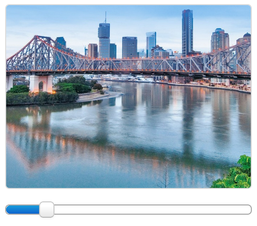
- Image
Locations can have an image associated with them. The image can be static (uploaded by user), or dynamically updated with an Attachment Source (within the Location). Select Fixed Image to upload an image or choose an existing image attachment (within the Location).

- Image zoom/pan
Fixed images can be zoomed and panned as required. Use the zoom slider to quickly zoom in/out and click or touch the image and drag around the preview container to pan.
- Quality Alarm
- See Alarms and Notifications.
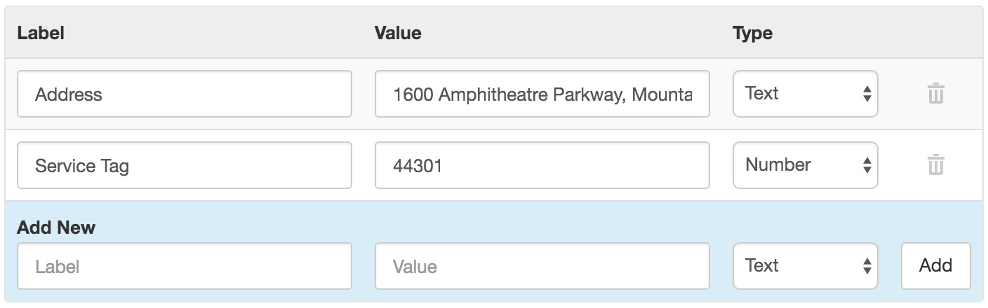
Metadata
Metadata provides a simple key/value data structure that can be used to store static information about the location. Values can be saved as Number or Text and are displayed in the Locations List View.
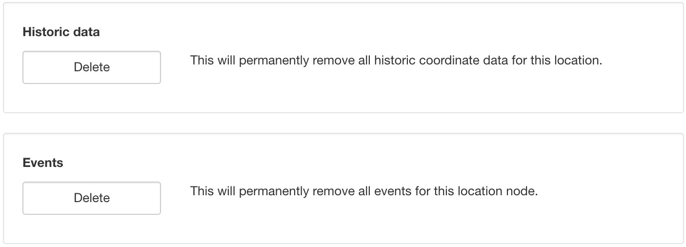
Historic
Click the Delete buttons and save to permanently remove all historic coordinate data or events for this Location node. Alternatively use the Source Historic section to delete historic data or events for a Data Source and its Parameters.
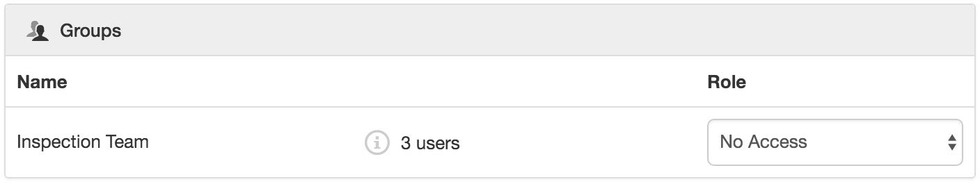
Security
The Security section displays a list of all users and groups that have access to the Node. Users with security permission can restrict user and group access to the node and its descendants by assign the No Access role.
New users and groups must be added via the Workspace Security section.
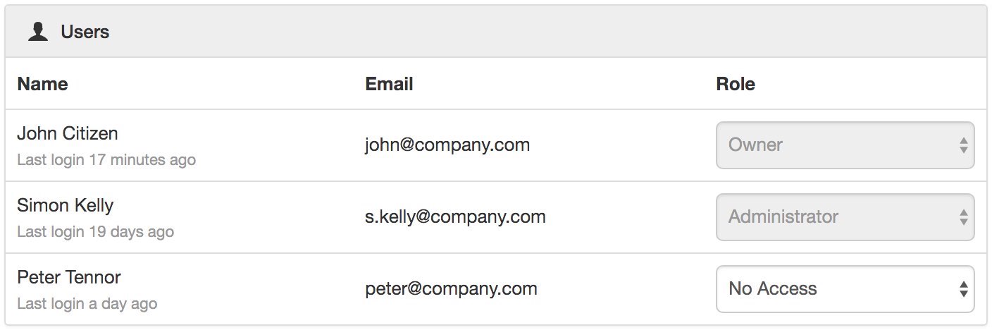
Note
The Account Owner, Administrators or Workspace users/groups that have been assigned a Workspace role with the configure permission can not be assigned the No Access role.